Client: Inticus
Project Summary:
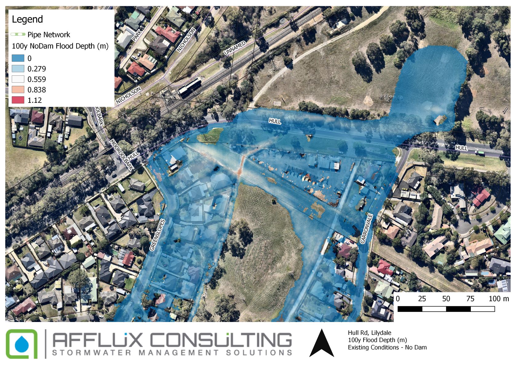
This project assessed of the proposed wetland / retarding basin at Hull Road, Lilydale, and in particular, break risks associated with the proposed dam wall. It covers the hydrology, and hydraulic analysis of the system, and includes a consequence assessment as per the ANCOLD guidelines.
The raingarden / retarding basin site is located west of Hull Road, approximately 3 km south of the Lilydale township. The asset is to provide treatment and retardation for the stormwater runoff generated from the urbanisation from the upstream catchment.
Project Outcome:
Several important points emerged from the range of modelling scenarios run. In terms of dam hydraulics, the modelling found that:
- The site and surrounding areas are exposed to existing flood risk.
- The proposed retarding basin was able to alleviate overall flood risk, and particularly to lots along the main road.
- Pipe blockages did not worsen the flood risk in major events because the basin is able to hold the 1% AEP volume.
- Assuming that the dam break trigger occurs when water levels reach the spillway weir, the modelling found that no break is likely in the dam until rarer storm events (< 0.1% AEP).
- Fall-back Flood Capacity for the spillway was a means of providing additional risk protection against an overtopping failure. A Fall-back spillway design of between 0.01% and 0.001% should be considered for the Basin.
Key Features and Innovations:
- Understanding the dam’s behaviour in various storm events.
- Impact to existing downstream properties and how to manage this safely.